FIRST WARN FORECAST: Summer loading. Highs matching Fourth of July in sight!
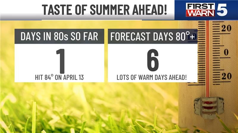
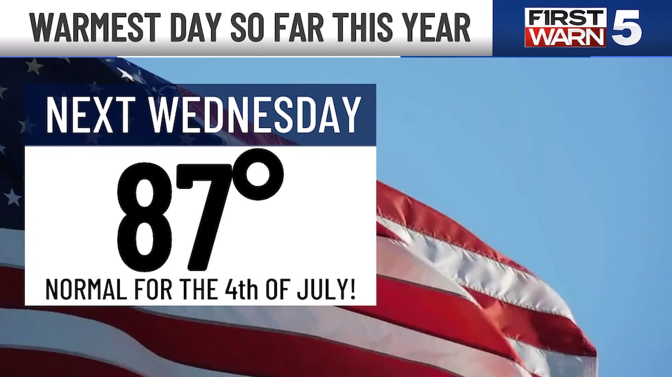
We are in a sweet stretch of spring weather lined up right into the weekend. Sunshine, light winds, low humidity, and warm afternoons will make for sensational outdoor weather. By next week, we will turn up the dial and crank up the heat to the warmest weather so far this year. By next Wednesday, we will match the average high for the 4th of July!
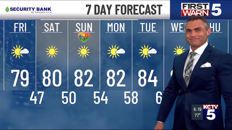
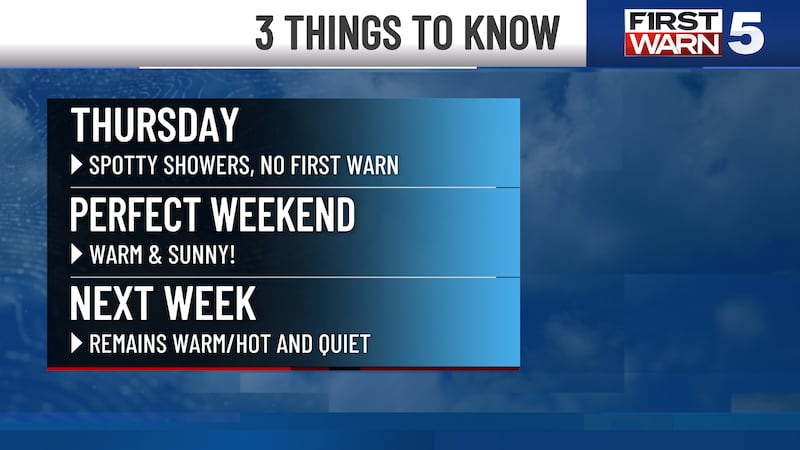
FRIDAY: Chilly in the morning with upper 40s, but we will warm rapidly to the upper 70s for the afternoon. Blue skies and light northeast breezes continue.
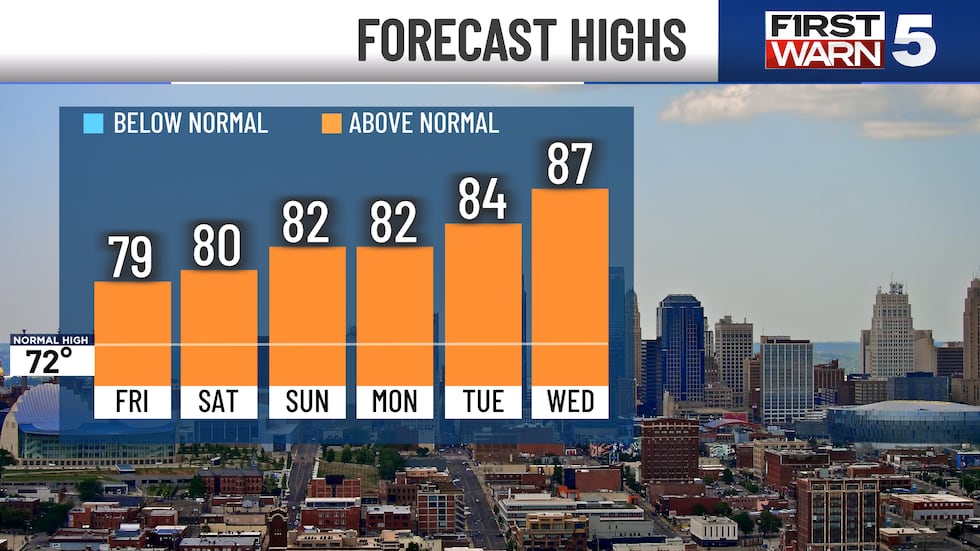
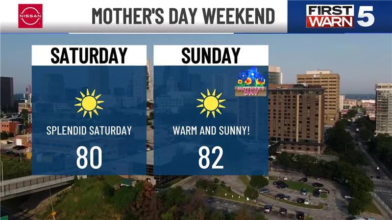
WEEKEND: Excellent both days with sunshine all weekend long. Low humidity and light winds remain. Highs in the low 80s.
NEXT WEEK: Warming up, with low 80s early in the week turning to upper 80s by Wednesday. The current forecast high for Wednesday is 87, which matches the normal high for the 4th of July (but humidity will not be at July levels). We are watching Thursday for a chance of storms. It doesn’t look like much at the moment, but the overall weather pattern will turn more active by late in the week and next weekend.
Copyright 2025 KCTV. All rights reserved.